Blog
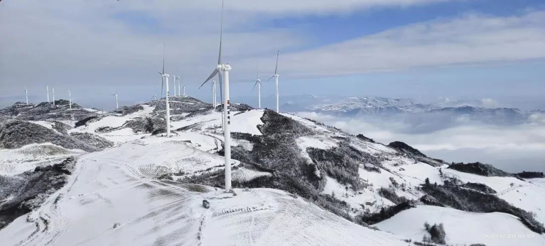
Wind turbine generator running during cold weather
Updated:2022-03-19 Attention:326
From March 16th to 17th, the temperature in the central and eastern regions dropped by 4 to 10 degrees Celsius, and in some areas, the temperature dropped by more than 12 degrees Celsius, accompanied by winds of magnitude 4 to 5 and gusts of magnitude 6 to 8. There have been two rain and snow events in most of North China and the southern part of Northeast China. After learning this important weather information, the editor silently put on the long pants.
It's not just the editor who needs to wear long pants.
Disaster weather such as cold wave is coupled with the complex local terrain, and abnormal wind conditions that exceed the design standards may occur, which increases the probability of tower sweeping, unit overload and instability, and adversely affects the safe and stable production of wind farms.
Combining weather forecasting, statistical forecasting and numerical weather forecasting, Goldwind continuously expands forecast data sources and forecasting methods, innovates the integration and fusion technology of intelligent deep algorithm for strong wind forecasting, and forms an early warning and evaluation technical scheme for disasters and strong winds. At present, the monitoring scope of the disaster and gale early warning and assessment technology covers hundreds of wind farms under construction and operating wind farms of Goldwind across the country.
Take the strongest cold wave in 2021, for example. On November 4, 2021, the Central Meteorological Observatory issued a cold wave yellow warning: the temperature in most parts of my country will drop by 8 to 10 degrees Celsius, and the decline in some areas in Northwest China, most of Inner Mongolia, North China, Huanghuai, western Jianghuai, and southern Northeast China can be reduced. The temperature reached 12-14°C, accompanied by northerly winds of magnitude 4-6 and gusts of magnitude 7-8.
Facing the super cold wave, Goldwind's R&D, quality and service teams formed the "Cold Wave Warning Iron Triangle". First, use various meteorological data sources to predict the evolution of the weather system; secondly, issue gale warnings for risk points of projects under construction and operation; thirdly, combine multiple data sources to give more accurate wind speed and direction prediction results. For the projects already in operation, the Audio-Technica Triangle cooperates closely to ensure the safety of the units to the greatest extent and reduce the loss of power generation. For projects under construction, according to the forecast data, Audio-Technica releases construction deployment instructions to the project site in real time to ensure the safe construction of the project.
As of November 14, 2021, relying on the technical scheme for early warning and assessment of disaster and strong winds, Goldwind has issued early warnings for 5 prototypes, 25 projects under construction and 40 projects in batch operation within the coverage area. The information shows that each project has achieved stable and orderly operation during this cold wave!
With the increase in the number of early-warning and monitoring wind farms, the expansion of early-warning objects and the expansion of the scope of meteorological early-warning, Goldwind has established a disaster-weather early-warning platform on the basis of the existing disaster and gale early-warning assessment technology to further improve the accuracy of weather early warning and the level of early warning automation. Minimize the disaster risk of wind farms and help wind turbines run safely and stably.


